Satplat services
Farm management (micro and macro level)
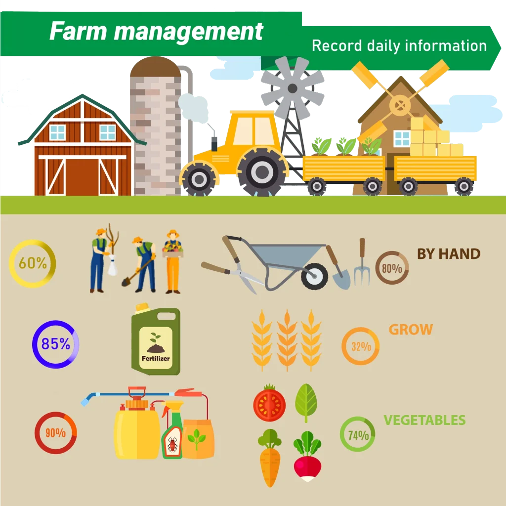
Record daily information
Field Specification
Monitoring
Meteorological Analysis
Irrigation Planning
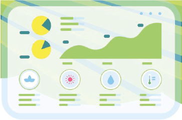
Dashboard Reporting Tool
Archive Field Information
Economic Farming planning
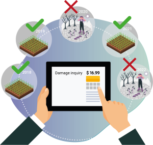
Using these features, a farmer can accurately record all relevant information about their agricultural land. This includes the precise geographical location of the farm, details of crop cultivation (such as crop type, planting date, type of base fertilizer, etc.), and operations performed (including the quantity and date of irrigation, fertilization, and pesticide spraying). Additionally, information related to harvest is also documented.
By recording initial information for each piece of land, including geographical location and type of crop, a certificate is created for each plot of land. This certificate will contribute to better and long-term management of agricultural plots.
The monitoring dashboard encompasses various sections designed to assist farmers in monitoring their fields throughout the growing season and staying informed about their health. This dashboard provides the capability to track growth trends, compare the status of multiple fields, estimate the performance of crops one month prior to harvest, visualize normal growth patterns, and access weather data along with its analysis.
NDVI
NDWI
NDRE
CHL
LAI
MSAVI
The normal growth chart allows the farmer to compare the growth of his crop with the growth of the crop in normal conditions. With this knowledge, the farmer can manage agricultural operations (irrigation, fertilization, spraying, etc.) at the right time.
The growth changes chart from the planting date allows the farmer to check the general changes of the farm and take proper actions if necessary. Also, it is possible to compare the growth chart in the farms where the same crop is grown, in the monitoring dashboard.
By combining satellite and meteorological data, the yield is estimated one month before harvest. With the knowledge of the crop yield, the farmer can plan properly for harvesting, storage, and transportation operations .
In the monitoring dashboard, the farmer can access the forecast of various variables such as average, maximum and minimum temperature, rainfall, wind speed and direction for the next 14 days, as well as the analysis of these variables
Irrigation planning is a water resource management method for the optimal use of water and preventing water wastage. In irrigation planning, the amount of water requirement for each plant is determined in different growth periods. At Setplat Company, irrigation planning is done by using satellite data, plant variables, and meteorological data for each cultivation period in agricultural plots.
Weekly report
Seasonal report
Comprehensive report
Specialized reports
In this section, all farm information including forms, maps, and reports is stored and archived. The existence of this archive prevents the dispersion of information and makes information management easy.
SetPlat Company provides economic planning services in the agricultural sector, focusing on optimizing all stages of the agricultural supply chain. Through market analysis, prioritization, and the utilization of cutting-edge technologies, the company assists farmers and producers in enhancing efficiency and improving performance to become competitive in both domestic and international markets. SetPlat is also dedicated to enhancing investments and facilitating the fair distribution of interests within the supply chain, aiming to accelerate sustainable agricultural development.
Agricultural Insurance
Insurance Platform
Climatic risk
Insurance Claim Process and Receiving an Estimate
Advice to Farmers for Reducing Damage
Ease of buying and managing insurance.- Difficulty in purchasing and handling insurance.
Saving money and the possibility of comparing different insurances.- Spending money without considering the options and neglecting the opportunity to compare various insurance plans.
Convenient access to information at any time.- challenge of accessing insurance information.
- Ease of buying and managing insurance.
Difficulty in purchasing and handling insurance.
- Saving money and the possibility of comparing different insurances.
Spending money without considering the options and neglecting the opportunity to compare various insurance plans.
- Convenient access to information at any time.
challenge of accessing insurance information.
These days, climate change and extreme climatic events such as drought, floods, heat waves, frost and strong winds are considered to be the biggest risk factors for production in agriculture. These events directly affect the quantity and quality of agricultural production, so that mostly affect in the opposite direction. Estimating the risk of climate hazards and planning for damage reduction are important steps for farmers, companies and policy makers. One of the most important things in the insurance industry is determining the risk of weather disasters in different regions because this factor is influential in determining the insurance premium.
- Quick and accurate assessment
- Online assessment
- Calculation based on insured capital
- Determining suspected fraud
Agricultural credits
This service is designed for the evaluation of farmers' capabilities in the cultivation and production of agricultural products. The assessment focuses on evaluating skills, technical knowledge, and overall performance of farmers to facilitate necessary improvements and developments in the field of agriculture.
In this field can investigate how natural disasters or management issues impact agricultural products, damage soil structure, and affect the economic livelihood of farmers. It can explore the extent to which these factors have influenced the growth process of crops. Such studies may encompass examining the physical and chemical changes in soil resulting from natural disasters and understanding how these changes impact the quality and performance of agricultural products.
Psychological tests in the field of agriculture and on agricultural land are tools designed to assess and understand psychological factors associated with farming activities and land users. These tests aim to explore aspects such as stress levels, capabilities, skills, and psychological behaviors in agricultural environments.
In the agricultural sector and on agricultural lands, assessing repayment ability is a crucial aspect in the process of providing platform services. This is done to ensure that farmers have the financial capacity to repay loans or other financial services. The assessment includes examining the farmer's income, living and farming expenses, assets, and liabilities, as well as other factors that impact their financial capability. This ensures that any service or loan is designed in a way that aligns with the farmer's financial capacity and repayment capabilities, assisting them in improving their agricultural conditions.
Agricultural Statistical Analysis and planning
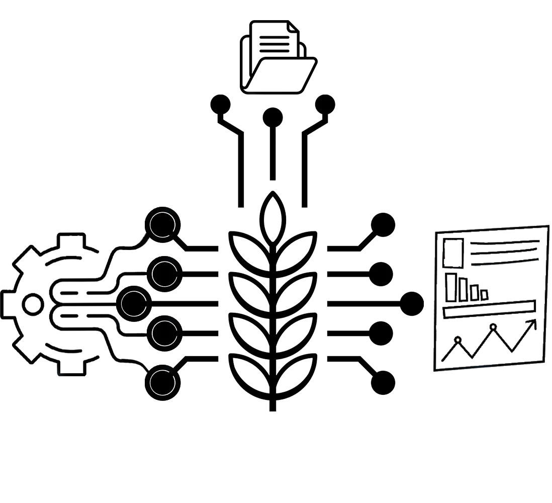
Collecting the Information
Domestic market planning
Crop Type Classification
Food import and export planning
Estimating the Amount of Production
Food security planning
Food Supply and Demand
Who benefits from using Satplat?
Farmers
Agricultural Company
Agricultural consultants
Government organizations
You can also become a member of the Satplat system and remotely monitor your farms with the help of smart agriculture……